Tuesday, Jun 20, 2023
Journalism of Courage
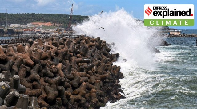 High tidal waves crash on the shore at the Vizhinjam harbour in Thiruvananthapuram. (PTI Photo/File)
 Cyclone Biparjoy, which struck India last week, was not unusual. Cyclones of this nature and ferocity routinely hit the Indian coastline about three to four times a year. May and June are months when cyclones are expected. On the western coast, Gujarat happens to be the most likely place for the east-moving cyclones in Arabian Sea to make landfall. And yet, Biparjoy had some characteristics that not only made it difficult to predict its path, but also made the cyclone potentially more dangerous.
The case of Biparjoy is a reminder that despite the enormous progress made in developing warning systems and acting on them, cyclones remain a huge threat. The fact that the reported death toll from Biparjoy has been in lower single digits, almost all of them accidental, is a marker of the success of the work done in the past 15 years. But much more needs to be done to minimise the damage to infrastructure, loss of cattle and other animals, and livelihoods of local populations.
Uncertain path
Unlike many other natural hazards, cyclones give adequate warning of their arrival. In the Indian context, it takes them between four and five days to reach the landmass from the north Indian Ocean, both on the Arabian Sea and the Bay of Bengal sides. If a sufficient number of weather instruments are monitoring them, from the oceans as well as from satellites, everything about the cyclones — speed, intensity, trajectory, associated wind speeds — can be predicted accurately.
Biparjoy developed into a cyclonic storm on June 6 and made its landfall on June 15. The 10-day life period, during which it developed into a very severe cyclonic storm and then an extremely severe cyclonic storm, was longer than the average but not the longest. One of the reasons for its longer stay on the sea was its relatively slow speed. Cyclones in the Arabian Sea typically progress with a speed of about 12-14 km per hour. Biparjoy, through most of its life, moved at a speed of 5-7 km an hour while covering a distance of nearly 1200 km to Gujarat.
“Biparjoy was sandwiched between two anticyclonic systems. One of them had the effect of aiding its northwards movement, while the other was sort of pulling it back. The combined effect was that it moved relatively slowly,” explained Mrutyunjay Mohapatra, director general of India Meteorological Department and expert on cyclones.
The influence of these anticyclonic systems also made its trajectory wobble. “We call it recurving tracks cyclone. The trajectory of such cyclones tends to change directions frequently. Predicting the trajectory of recurving cyclones is extremely challenging, with an extra element of uncertainty,” Mohapatra said.
Towards Gujarat
Cyclone Biparjoy was earlier predicted to proceed towards Karachi in Pakistan. The Indian coastline would have felt the impact, but the landfall was not expected over Indian land. It was only on June 11 that the IMD declared that the cyclone was headed towards the northwestern Gujarat coast.
“At that time, most other international agencies were still saying the cyclone was headed to Karachi. That was because a few weather models were indeed predicting that. But we have a strong observational network in this area, and good experience with forecasting cyclones. By Sunday (June 11), we were reasonably sure the cyclone was coming to the Gujarat coast,” Mohapatra, credited with improving India’s cyclone forecast system, said.
Taking an early call was crucial, because that set in motion the response mechanism. A meeting of the National Crisis Management Committee on June 12 studied the forecast and sent out directives to the state government and the local administration to prepare for a landfall three days later. This was sufficient time to evacuate nearly one lakh people from the danger zones to safer locations.
The intensity of the cyclone was showing unusual variations. At times, it appeared that it was weakening, only to regain its strength later. That produced additional complexities in predicting its likely damage potential.
Persistent cyclone
The relatively slow speed of Biparjoy had extended till the landfall, making the process slightly longer than average, though not extraordinary. Most cyclones of this intensity complete the landfall in about three to four hours. Biparjoy took about five hours. The slow speed meant that even after reaching land, the cyclone remained close enough to the sea to draw moisture and sustain itself.
Longer landfalls have a greater potential to cause destruction. The most dramatic landfall was in the case of the Odisha supercyclone of 1998, the most devastating cyclone to have hit India in recent decades. That process had continued for nearly 30 hours.
Usually, cyclones lose their energy very quickly once they cross over to land. But because it could sustain itself for longer, Biparjoy kept moving on land as well, though with significantly reduced intensity. Its remnants had reached as far inside as Ajmer in Rajasthan on Monday, four days after landfall. Many parts in western and central India received widespread rains because of this system travelling over land.
“In a way, every cyclone is unique. No two cyclones have the same characteristics. Biparjoy had some additional complexities, which made forecasting extremely challenging. But our cyclone forecasting is now among the world’s best. That said, we need to keep improving it because future cyclones, under the influence of climate change, are going to throw bigger challenges,” Mohapatra said.